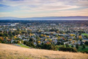
California is a hiker’s paradise unlike anywhere else on Earth. Within a single state, you can walk beneath thousand-year-old redwood canopies, scramble up volcanic peaks, traverse knife-edge granite ridges above Yosemite Valley, wander through desert oases shaded by native fan palms, and backpack along one of the most remote stretches of coastline in North America.
The Golden State encompasses more than 163 million acres of terrain spanning coastal bluffs, old-growth forests, alpine meadows, volcanic highlands, and sun-scorched desert basins. It is home to nine national parks (more than any other state), 280 state parks, and 18 national forests, threaded together by tens of thousands of miles of maintained hiking trails, many of them counted among the best hikes in California.
This guide presents 25 of the best hikes in California, carefully curated to represent every skill level, every major region of the state, and the extraordinary diversity of landscapes that make California a world-class hiking destination. Whether you are lacing up hiking boots for the first time or training for a multi-week thru-hike along the Sierra crest, there is a trail here with your name on it among the best hikes in California.
The hikes are organized into three tiers: Beginner trails ideal for families, first-timers, and casual walkers; Moderate trails that offer more of a physical challenge and richer wilderness immersion; and Strenuous to Expert trails that demand serious fitness, preparation, and in some cases mountaineering skills.
A note on safety: trail conditions can change rapidly due to weather, wildfire, rockfall, and seasonal closures. Always check current conditions with the managing agency before heading out. Carry the Ten Essentials, tell someone your itinerary, and know your limits. California’s wild places are breathtaking, and exploring the best hikes in California demands respect.
1. Muir Woods Main Trail — One of the Best Hikes in California for Beginners
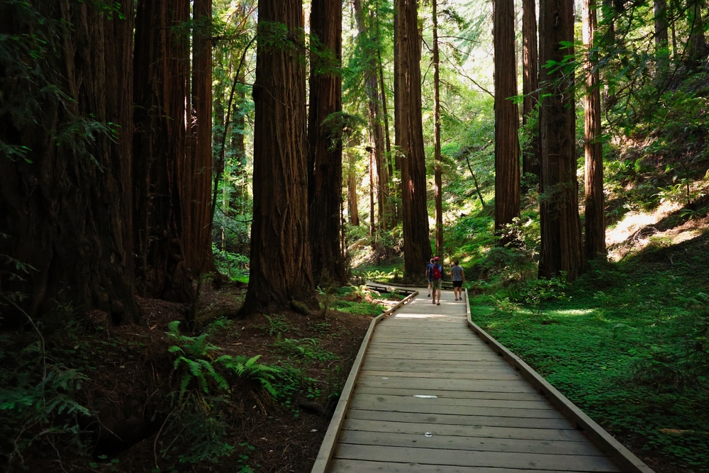
Muir Woods National Monument is one of the most accessible old-growth coastal redwood forests in the world, located just 12 miles north of San Francisco. The Main Trail is a flat, paved boardwalk that winds beneath towering coast redwoods, some over 250 feet tall and more than 1,000 years old. Serene Redwood Creek runs alongside the path, and lush ferns carpet the forest floor. A great feature is that the canopy filters the sunlight into ethereal beams that make every step feel like walking through a cathedral.
This is an ideal first hike for families, seniors, and anyone looking to experience California’s ancient forests without breaking a sweat. Due to its popularity, parking reservations through Recreation.gov are mandatory, and visiting during weekday mornings offers the most peaceful experience.
2. Lands End Trail
Perched on the northwest edge of San Francisco within the Golden Gate National Recreation Area, the Lands End Trail delivers some of the most dramatic coastal scenery in the Bay Area. The path traces the rugged cliffs above the Pacific Ocean, offering sweeping views of the Golden Gate Bridge, the Marin Headlands, and the remains of the Sutro Baths.
Wildflowers bloom along the trail in spring, and on clear days the Farallon Islands shimmer on the horizon. The path is well-maintained with a mix of packed dirt and wooden steps, making it comfortable for most fitness levels. History buffs will appreciate the shipwreck remnants visible at low tide and the nearby ruins of Adolph Sutro’s once-grand bathhouse complex.
Free parking is available at the Lands End Lookout Visitor Center, and public transit access via Muni makes this one of the most convenient hikes in the state.
3. Torrey Pines State Natural Reserve — A Southern California Best Hike
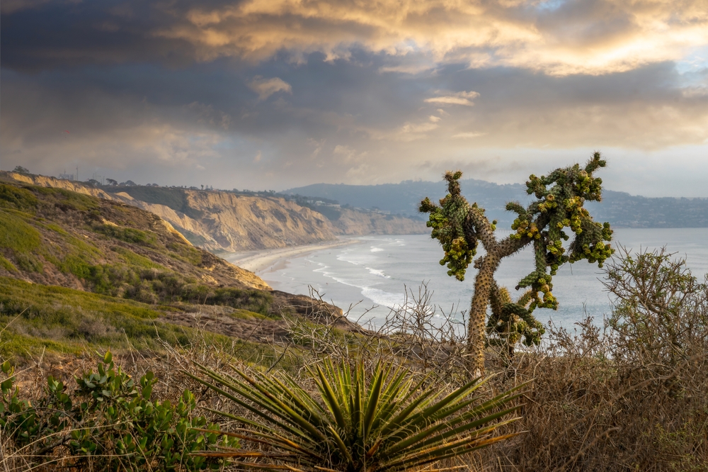
Torrey Pines State Natural Reserve protects one of the rarest pine species in the world and features some of the most breathtaking coastal scenery in Southern California. The reserve offers several interconnected trails that wind through dramatic sandstone formations sculpted by wind and time, with the Pacific Ocean as a constant backdrop.
The Guy Fleming Trail loop is perfect for beginners, passing through groves of the namesake Torrey pines and arriving at overlooks with panoramic ocean views. On the other hand, the Razor Point Trail leads to a cliff-edge viewpoint where the eroded badlands meet the sea far below.
Spring brings a vibrant display of wildflowers, and year-round you may spot dolphins, sea birds, and the occasional gray whale migrating offshore. No food or beverages (other than water) are permitted on the trails, and dogs are not allowed in the reserve.
4. Fern Canyon
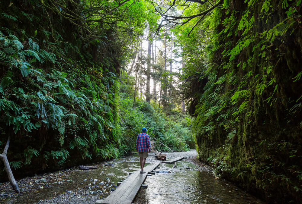
Fern Canyon is a natural wonder where 50-foot walls draped in seven species of fern create a lush, prehistoric setting so stunning that Steven Spielberg used it as a filming location for Jurassic Park 2: The Lost World.
The short loop trail follows Home Creek through the narrow, moss-covered canyon before circling back along the rim. Stepping stones and small footbridges help hikers cross the shallow creek multiple times. The biggest challenge is actually reaching the trailhead: Davison Road requires crossing several seasonal stream fords that may need a high-clearance vehicle.
Once there, the hike itself is flat and family-friendly. Visiting after winter rains ensures the canyon walls are at their most vibrant, with water trickling down the fern-covered surfaces. This is a short hike that delivers an outsized sense of wonder.
5. Griffith Observatory Trail — An Urban Classic Best Hike in California
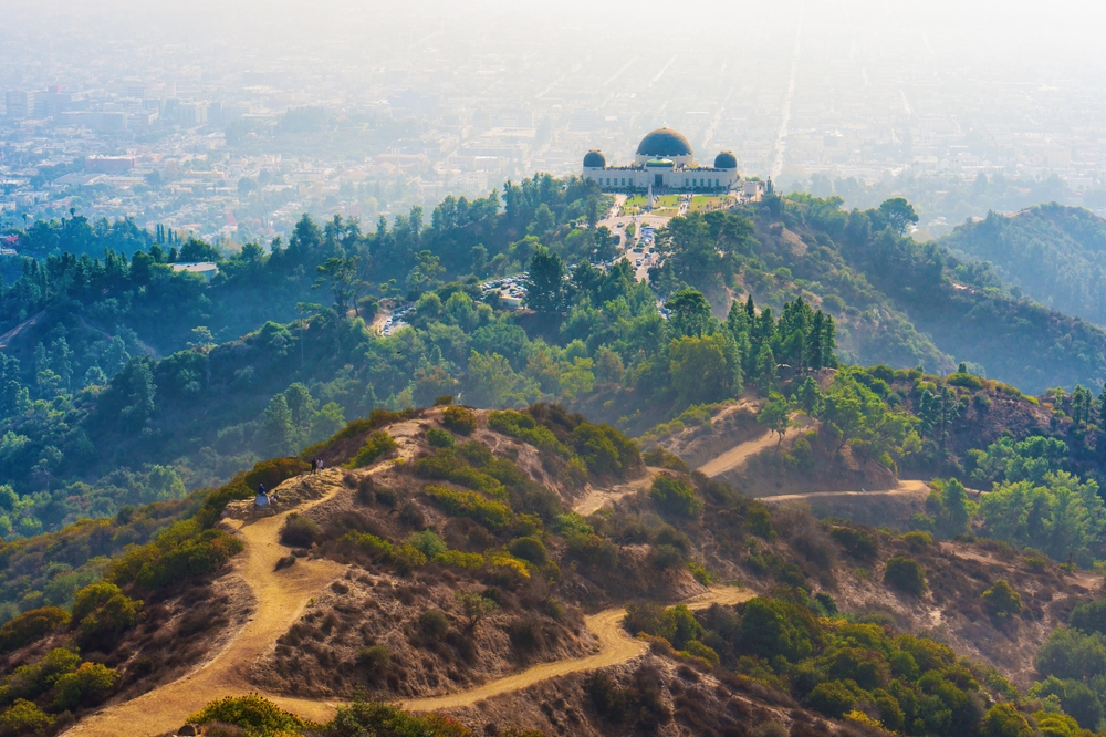
The trail to Griffith Observatory is the quintessential Los Angeles hiking experience. Beginning from the Fern Dell parking area or the Western Canyon trailhead, the path climbs gently through chaparral-covered hillsides before arriving at the iconic Art Deco observatory perched on the southern slope of Mount Hollywood. Along the way, hikers enjoy panoramic views of the Los Angeles skyline, the Hollywood Sign, and on clear days the Pacific Ocean and Catalina Island.
The trail surface is a mix of paved road and packed dirt, well-marked and accessible to most fitness levels. Sunset hikes are particularly popular, as the city lights begin to twinkle below while the sky turns orange and pink. The observatory itself offers free admission with planetarium shows, telescopes, and exhibits, making this a perfect half-day outing that combines exercise with culture.
6. Mono Lake South Tufa Trail
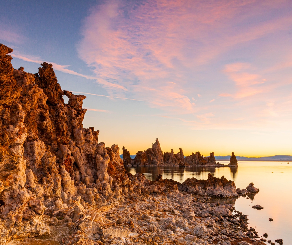
Mono Lake is one of the oldest lakes in North America, and its South Tufa area feels like stepping onto another planet. The short, flat trail leads past towering calcium-carbonate tufa towers that formed underwater and were exposed as the lake level dropped due to water diversion. These other-worldly spires stand against a backdrop of the Sierra Nevada crest and the vast Great Basin sky.
The lake is nearly three times as salty as the ocean and home to trillions of brine shrimp that sustain millions of migratory birds, making it one of the most important avian habitats in the western United States. Sunrise and sunset transform the tufa formations into glowing sculptures of gold and purple, which is a must-see.
This is an easy walk suitable for all ages, and it pairs perfectly with a visit to Bodie Ghost Town or a drive along the June Lake Loop.
7. McWay Falls Overlook Trail — One of the Best Hikes in California on the Coast
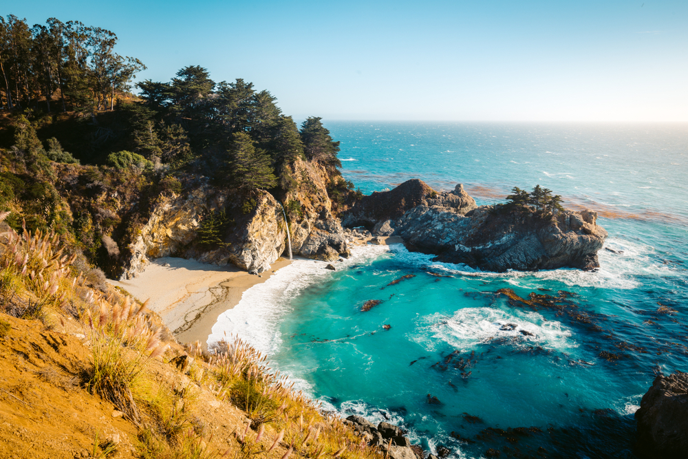
McWay Falls is perhaps the most photographed waterfall in California: an 80-foot cascade that tumbles directly onto a pristine, turquoise-watered cove on the Big Sur coastline. The trail to the overlook is short, flat, and paved, making it one of the easiest yet most rewarding walks in the entire state.
The path passes through a short tunnel under Highway 1 before arriving at a fenced overlook perched on the cliff above the falls. Below, the waterfall plunges onto a crescent of sandy beach that is inaccessible to visitors, preserving its untouched beauty. The surrounding hillsides are covered in coastal scrub and occasional stands of redwood.
This stop is a must on any Big Sur road trip and can be combined with other nearby attractions like Pfeiffer Beach and the Bixby Creek Bridge. Parking is very limited, so arriving early is essential, especially on weekends.
8. Point Lobos Loop Trail
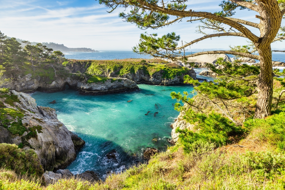
Often called the crown jewel of the California State Park system, Point Lobos State Natural Reserve packs an extraordinary amount of natural beauty into a compact coastal headland just south of Carmel-by-the-Sea. The loop trail connects several shorter paths that pass through groves of ancient Monterey cypress trees, vibrant tide pools, hidden coves, and rocky headlands where harbor seals haul out to rest. Sea otters float in the kelp beds just offshore, and from December through April, migrating gray whales can often be spotted from the trail.
Bird Rock and China Cove are two standout viewpoints, and the Cypress Grove Trail passes through one of only two naturally occurring stands of Monterey cypress on Earth. The trail is well-maintained with only gentle elevation changes, making it accessible to hikers of nearly all abilities. Entry is limited to control crowding, so arriving before 10 a.m. is recommended.
MODERATE HIKES (9–17)
Trails with more elevation gain, longer distances, and varied terrain that reward hikers with deeper wilderness experiences.
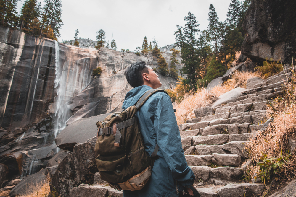
9. Mist Trail to Vernal Falls — Yosemite’s Best Hike for Waterfalls
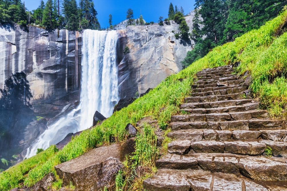
The Mist Trail is widely considered Yosemite’s signature day hike, and for good reason. The trail climbs granite staircases alongside the thundering Merced River to the brink of Vernal Fall, a 317-foot curtain of water that generates so much spray that hikers are thoroughly soaked during peak flow in May and June. The granite steps are steep and can be slippery, but the reward is extraordinary: standing at the rim of one of the world’s most photogenic waterfalls with views back down the valley.
Ambitious hikers can continue another 1.5 miles to the top of 594-foot Nevada Fall, making the round trip roughly 7 miles with 2,000 feet of elevation gain. The Mist Trail is also the starting route for the famous Half Dome hike. Start early to avoid afternoon crowds and bring a rain jacket regardless of weather, as the mist is constant and heavy. Parking at the Yosemite Valley trailhead fills quickly, so the free shuttle to Happy Isles (Stop 16) is the most reliable option.
10. Sentinel Dome and Taft Point
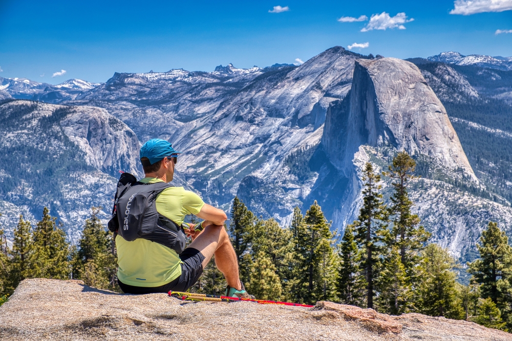
Sentinel Dome and Taft Point are two of Yosemite’s best-kept secrets for hikers who want world-class views without the extreme effort of Half Dome. Both trails start from the same parking area along Glacier Point Road. Sentinel Dome is a short but steep scramble up smooth granite to a 360-degree panoramic viewpoint at 8,122 feet, offering unobstructed views of Yosemite Falls, Half Dome, El Capitan, and the High Sierra.
Taft Point, meanwhile, takes hikers to a dramatic cliff edge that drops 3,000 feet straight into the valley, with natural fissures in the granite that provide dizzying vertical glimpses to the floor below. A metal railing marks the edge, but much of the overlook is unfenced, making it thrilling and slightly nerve-wracking. Combining both hikes into a single outing creates one of the best moderate hiking experiences in all of California.
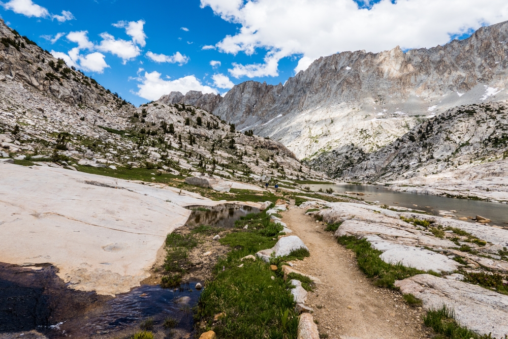
11. Eagle Lake Trail — A Tahoe Favorite
The Eagle Lake Trail near Lake Tahoe’s Emerald Bay is a short but rewarding climb through granite terrain to a stunning alpine lake nestled in a glacial cirque. The trail begins across Highway 89 from Emerald Bay and ascends via well-worn rock stairs past Eagle Falls, a picturesque cascade that makes a great photo stop within the first few minutes.
From there, the trail continues to climb through Jeffrey pine and red fir forest before opening up at Eagle Lake, whose crystal-clear waters reflect the surrounding granite cliffs. The western shore offers what many consider one of the most beautiful views in all of California, looking back through the U-shaped valley toward Emerald Bay and the deep blue expanse of Lake Tahoe beyond.
Pack a lunch and plan to linger. The trailhead parking lot is small and fills very early on summer weekends, often by 8 a.m.
12. Sandstone Peak Trail
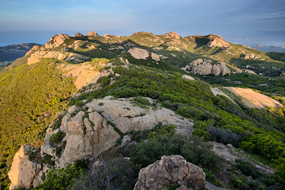
Sandstone Peak, also known as Mount Allen, is the highest point in the Santa Monica Mountains at 3,111 feet and offers panoramic views that stretch from the Channel Islands to the San Gabriel Mountains. The Mishe Mokwa Trail to Sandstone Peak forms a scenic loop through some of the most dramatic rock formations in Southern California, including Balanced Rock, a precariously perched boulder that defies gravity.
The trail winds through fragrant chaparral, past massive granite outcroppings, and beneath shady groves of live oak. The final push to the summit involves a short rock scramble, but the 360-degree views from the top are well worth it. On clear days, you can see Catalina Island, the vast Pacific Ocean, and the sprawling tapestry of the Conejo and San Fernando Valleys.
This is one of the best day trips from Los Angeles, offering a wilderness experience surprisingly close to the city.
13. Joshua Tree: 49 Palms Oasis Trail — The Best Hike in California’s Joshua Tree
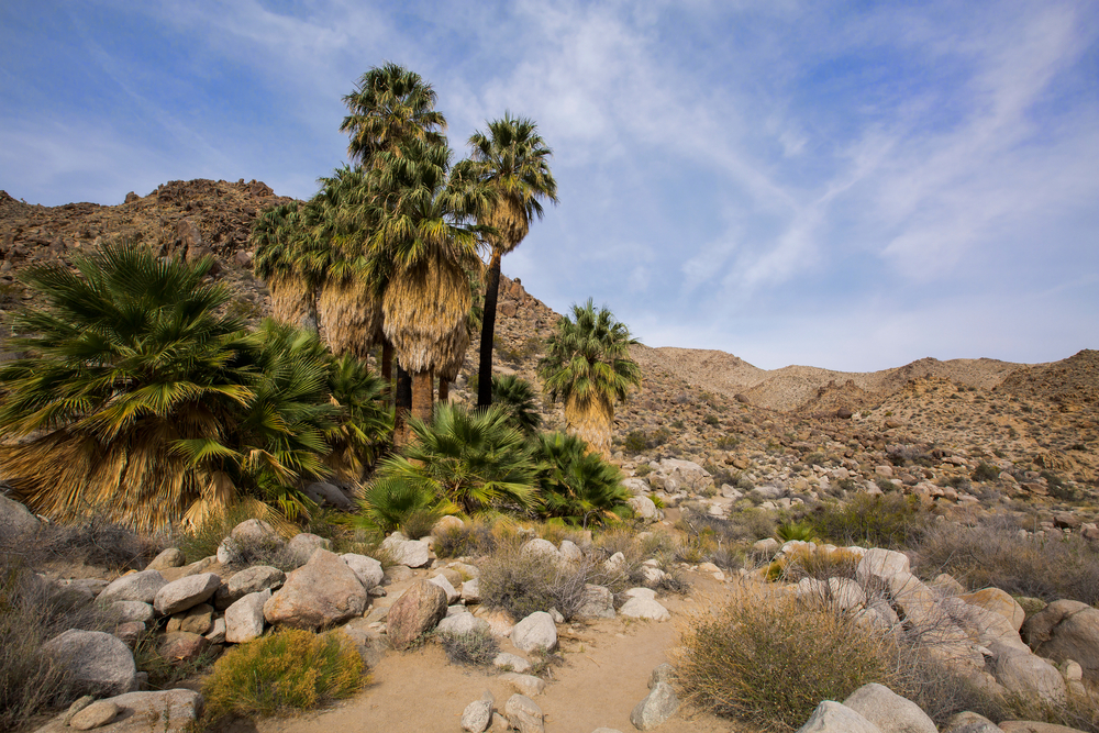
The 49 Palms Oasis Trail is a hidden gem in Joshua Tree National Park that transports hikers from the stark Mojave Desert into a lush, palm-shaded oasis. The trail crosses over a rocky ridge with sweeping views of the surrounding desert landscape before descending into a secluded canyon where native California fan palms cluster around natural pools of fresh water. The contrast between the barren, boulder-strewn hillsides and the green oasis below is striking and uniquely Californian. Bighorn sheep are occasionally spotted in the area, and birders will find the oasis teeming with life.
The trail is exposed with minimal shade, so bringing ample water and sun protection is essential. Avoid hiking during midday in the warmer months, as temperatures regularly exceed 100 degrees Fahrenheit. This trailhead is accessed from a separate entrance on Canyon Road, away from the park’s main entrances.
14. Pinnacles High Peaks Trail
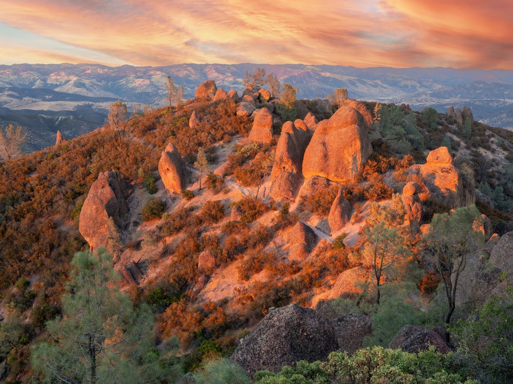
Pinnacles National Park is one of California’s most underrated national parks, and the High Peaks Trail is its crown jewel. The trail climbs through a landscape of towering volcanic spires, or pinnacles, that are remnants of an ancient volcanic field formed 23 million years ago and carried 200 miles northwest by the San Andreas Fault. The route includes steep stone steps carved into the rock, narrow passages between boulders, and handrail-assisted sections along exposed cliff faces. From the high points, hikers have sweeping views across the Gabilan Range and the Salinas Valley.
The park is also one of the best places in California to spot endangered California condors soaring overhead. The Condor Gulch Trail offers a shorter option for those hoping to see these magnificent birds. Summer temperatures regularly exceed 100 degrees Fahrenheit, making spring and fall the ideal seasons. The park has two entrances (east and west) that are not connected by road.
15. Bridge to Nowhere — The Best Hike in California for Adventure
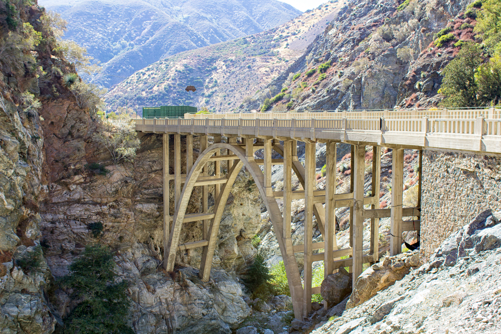
The Bridge to Nowhere is one of Southern California’s most unique hiking destinations. This 10-mile out-and-back trail follows the East Fork of the San Gabriel River through a narrow canyon, crossing the river multiple times before arriving at a massive concrete bridge standing improbably in the middle of the wilderness. The bridge was built in 1936 for a mountain highway that was destroyed by a catastrophic flood in 1938 and never rebuilt.
Today, the bridge serves as a bungee jumping platform on weekends, adding an adrenaline-fueled element to the hike. The numerous stream crossings, some of which are waist-deep during spring runoff, make this a refreshing summer adventure. Raspberry bushes and wildflowers line the riverbanks, and the canyon walls close in dramatically as you approach the bridge. Waterproof footwear or sandals with good grip are essential for the creek crossings.
16. Lassen Peak Trail
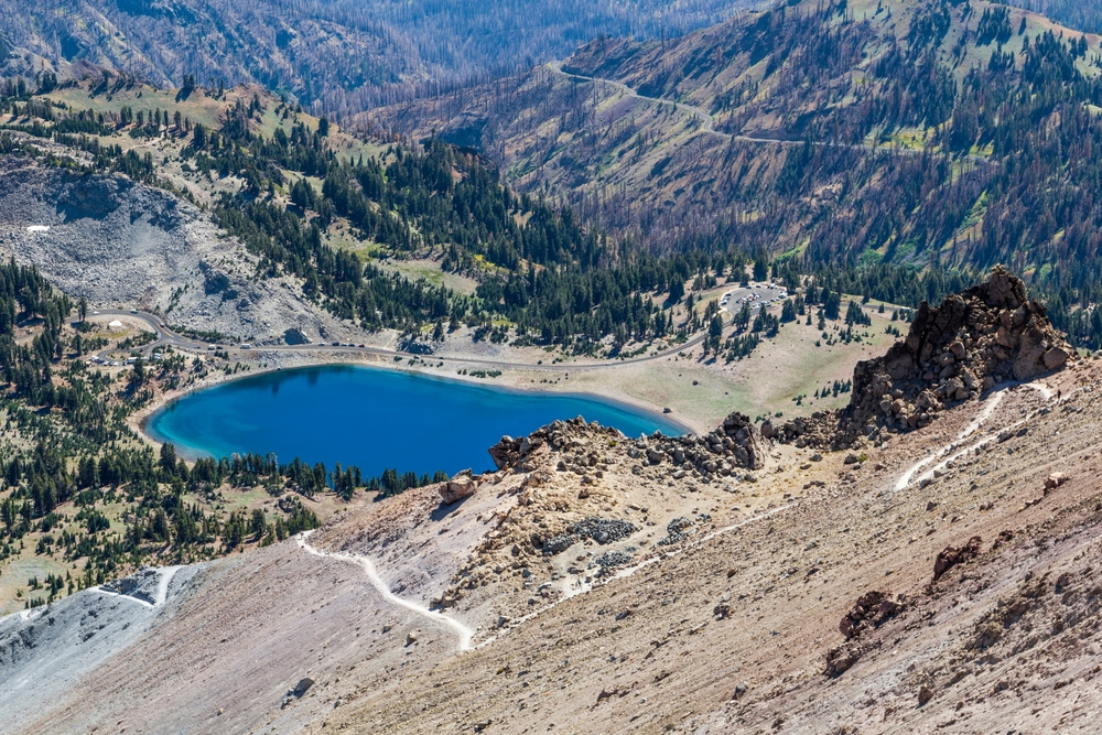
Lassen Peak is the southernmost active volcano in the Cascade Range, and hiking to its 10,457-foot summit is one of the most rewarding moderate hikes in Northern California. The trail begins at 8,500 feet along the Main Park Road and climbs steadily via well-graded switchbacks through alpine terrain. The final stretch crosses a rocky, exposed ridge to the summit, where hikers are rewarded with breathtaking views of the surrounding volcanic landscape, including the devastated area from the 1915 eruption, the painted dunes, and on clear days, Mount Shasta 100 miles to the north.
The high elevation starting point means the hike is shorter than it might otherwise be, but the thin air can slow hikers who are not acclimatized. Afternoon thunderstorms are common in summer, so an early start is strongly recommended. The park is significantly less crowded than Yosemite or Sequoia, making it an excellent choice for hikers seeking solitude.
17. Potato Harbor Trail — The Best Hike in California for Biodiversity
Channel Islands National Park is often called the Galapagos of North America, and hiking Potato Harbor on Santa Cruz Island is one of the most unforgettable experiences in California. After a one-hour boat ride from Ventura Harbor aboard the Island Packers ferry, hikers arrive at Scorpion Anchorage and follow a well-marked trail through rolling grasslands to a cliff-top overlook above Potato Harbor, a stunning crescent-shaped cove with turquoise water that rivals the Caribbean.
The trail offers sweeping ocean views the entire way, and the island’s unique flora and fauna, including the diminutive island fox found nowhere else on Earth, make every step feel like an adventure. The lack of development, roads, and permanent residents gives the island an untouched quality that is vanishingly rare in Southern California. Pack everything you need, including all water and food, as there are no services on the island.
STRENUOUS & EXPERT HIKES (18–25)
Demanding trails and mountaineering routes for experienced, well-conditioned hikers seeking California’s most epic adventures.
18. Half Dome
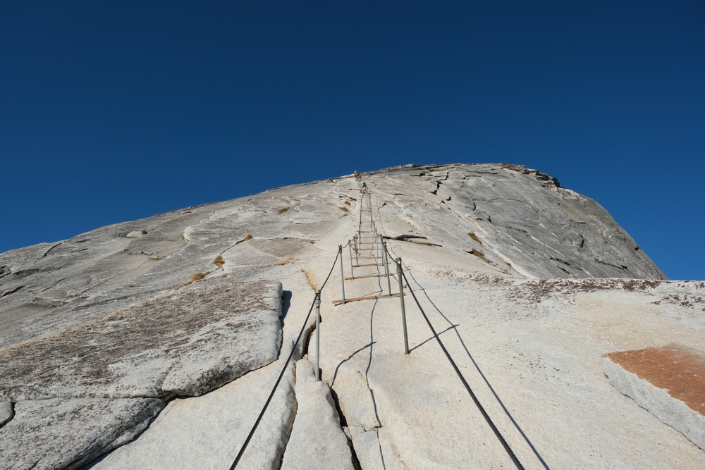
Half Dome is the ultimate California hiking achievement and one of the most iconic hikes in the world. The grueling 14- to 16-mile round trip from Happy Isles gains nearly 5,000 feet of elevation, passing two magnificent waterfalls (Vernal and Nevada Falls), traversing Little Yosemite Valley, and culminating in a heart-pounding cable ascent up the final 400 feet of smooth granite to the 8,846-foot summit. Steel cables bolted into the rock, with wooden plank footholds placed every few feet, are the only thing between you and a sheer drop on either side. The views from the top are unparalleled: a 360-degree panorama of Yosemite Valley, the High Sierra, and the surrounding granite domes.
Due to the hike’s extreme popularity and the dangers involved, a permit obtained through a preseason lottery (March) or daily lottery (two days prior) is mandatory. No more than 300 day hikers are permitted per day. This hike demands serious physical preparation, adequate water (at least 4 liters), and an early start, ideally before dawn.
19. Clouds Rest — The Best Hike in California for Yosemite Views
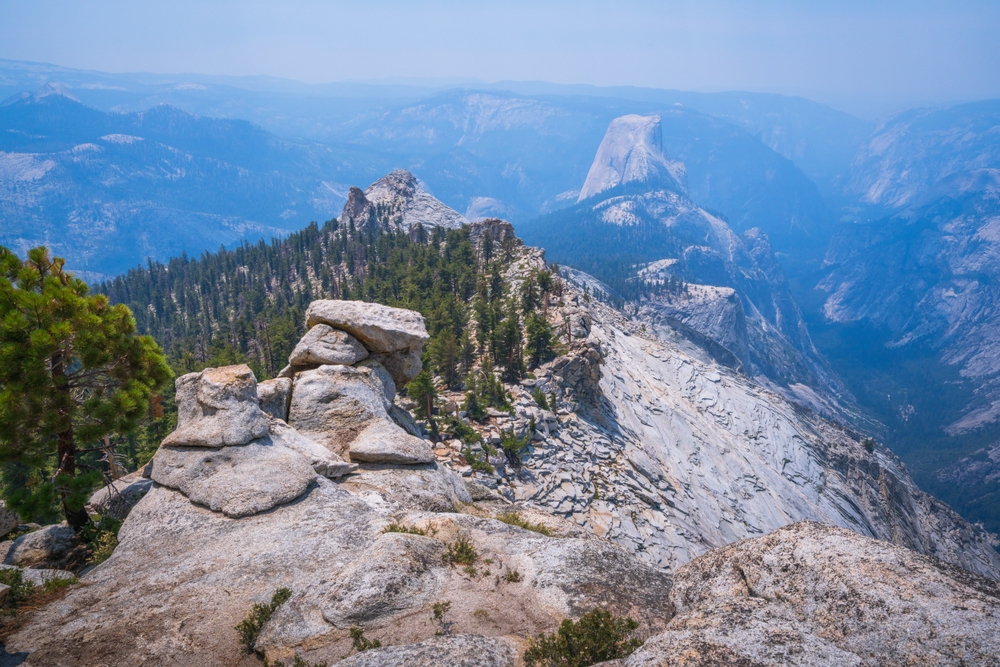
Many seasoned Yosemite hikers argue that Clouds Rest actually offers a better view than Half Dome, and unlike its famous neighbor, no cables or lottery permit are required. The trail from the Sunrise Lakes Trailhead near Tenaya Lake climbs steadily through forests and past granite slabs before arriving at the dramatic knife-edge ridge leading to the 9,926-foot summit. The final approach is narrow and exposed, with steep drop-offs on both sides that make it thrilling for adventurous hikers.
From the top, the panorama is extraordinary: Half Dome appears below you, Yosemite Valley stretches to the west, Tenaya Lake glitters to the north, and the Cathedral Range and Clark Range fill the eastern horizon. The trail is long but the grade is generally moderate, making it an excellent option for fit hikers who want an epic Yosemite experience without the permit hassle. Start early to beat crowds and afternoon thunderstorms.
20. Mount Baldy (Devil’s Backbone Trail)
Mount San Antonio, known locally as Mount Baldy, is the highest peak in the San Gabriel Mountains at 10,069 feet and the tallest summit in Los Angeles County. The Devil’s Backbone route is the most popular path to the top and features one of the most exhilarating ridge walks in Southern California: a narrow trail along a steep, exposed spine with dramatic drop-offs on both sides. The panoramic views from the summit encompass the Los Angeles Basin, the Pacific Ocean, the Mojave Desert, and on exceptional days, the Channel Islands and even Mount San Jacinto 80 miles to the southeast.
In winter and early spring, the Devil’s Backbone becomes dangerously icy and is only suitable for experienced mountaineers with crampons and ice axes. During the snow-free months, however, the trail is a challenging but non-technical route that rewards strong hikers with one of the finest summit experiences in Southern California. The ski lift at Mount Baldy Resort can shorten the hike by about 3 miles.
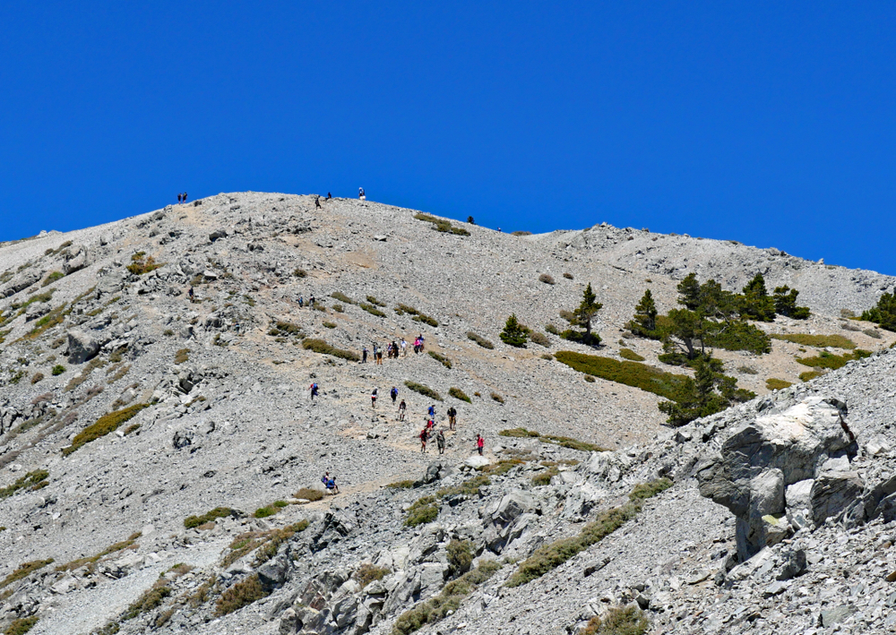
21. Mount Whitney — The Best Hike in California for Altitude
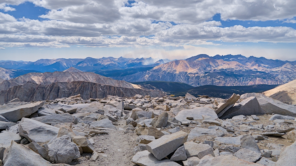
At 14,505 feet, Mount Whitney is the highest peak in the contiguous United States and one of the most coveted hiking achievements in North America. The Mount Whitney Trail from Whitney Portal is the standard non-technical route, covering 22 brutal miles with over 6,100 feet of elevation gain.
The trail ascends through pine forest, crosses numerous switchbacks known as the 97 Switchbacks, passes pristine alpine lakes including Trail Camp at 12,000 feet, and finally crosses the exposed Whitney Crest to the summit. The thin air above 12,000 feet makes every step significantly harder, and altitude sickness is a real concern for hikers who do not acclimatize beforehand. Weather can turn rapidly at high elevation, with lightning storms posing a serious danger on the exposed summit ridge.
Permits are distributed through a competitive lottery system and are among the hardest to obtain in the national park system. For those who succeed, standing on the highest point in the Lower 48 is a life-defining moment.
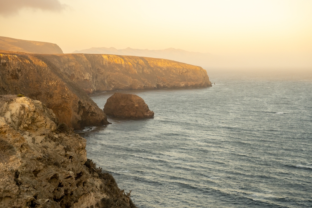
22. Lost Coast Trail

The Lost Coast Trail is California’s premier coastal backpacking experience. Located along the most remote and undeveloped stretch of coastline in the state, this 24.6-mile trail runs between Mattole Beach and Black Sands Beach through the King Range National Conservation Area. The terrain is relentlessly challenging, alternating between soft sand, slippery cobblestones, and rocky tidepools. Several sections are impassable at high tide, making a tide chart an essential piece of gear.
The rewards are immense: pristine black-sand beaches, thundering surf, sea lions hauled out on rocks, and the complete absence of roads, buildings, and cell service. The King Range rises steeply from the ocean, creating a dramatic backdrop of steep, forested mountains plunging directly into the Pacific. Roosevelt elk, black bears, and bald eagles are regularly spotted. A car shuttle between the two trailheads is necessary, and bear canisters are required for all overnight trips.
23. Telescope Peak — The Best Hike in California for Panoramic Desert Views
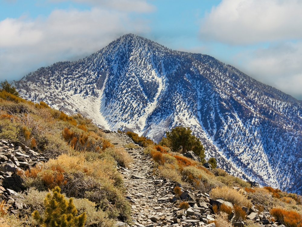
Telescope Peak is the highest point in Death Valley National Park at 11,049 feet, and the hike to its summit is one of the most unique in California. The trail begins at Mahogany Flat Campground at roughly 8,100 feet and climbs through groves of ancient bristlecone pines, some of the oldest living organisms on Earth, before reaching the windswept summit.
From the top, the panorama is staggering: Badwater Basin, the lowest point in North America at 282 feet below sea level, lies directly below to the east, while 14,505-foot Mount Whitney, the highest point in the Lower 48, is visible to the west. This means you can see both the highest and lowest points in the contiguous United States from a single vantage point.
The access road to the trailhead is rough and unpaved, requiring a high-clearance vehicle. Bring layers, as temperatures can vary dramatically, and desert weather is notoriously unpredictable.
24. Sierra Buttes Fire Lookout
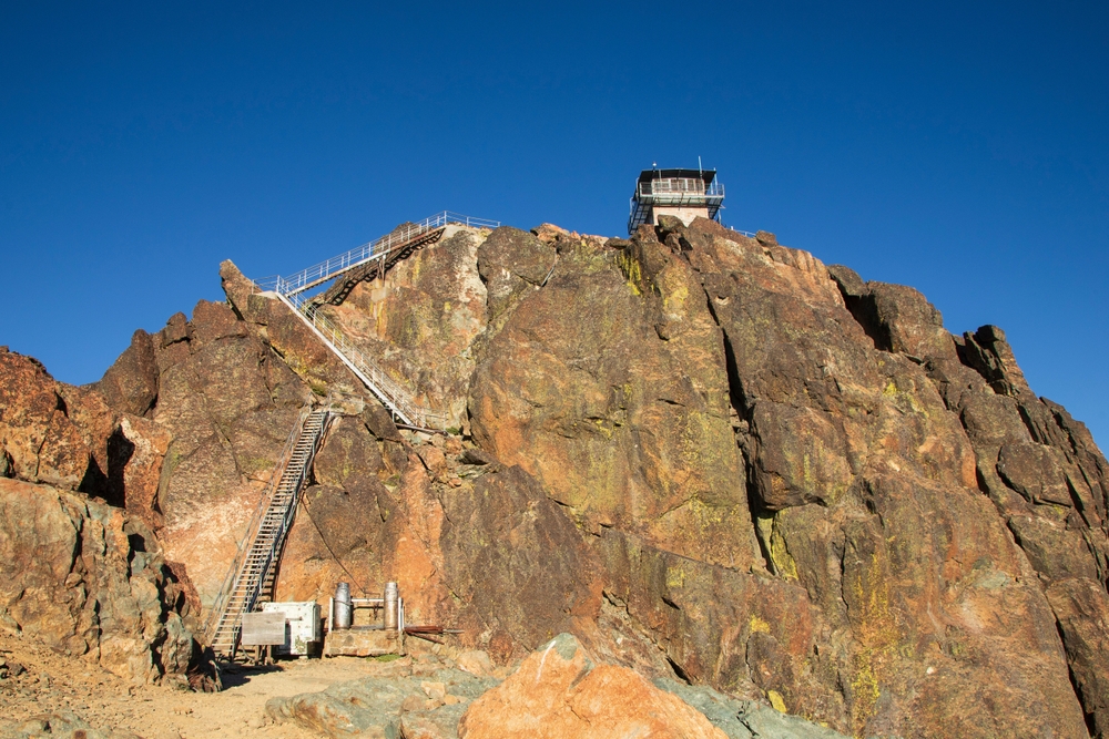
The Sierra Buttes Fire Lookout is one of the most thrilling hiking destinations in Northern California. The trail climbs through mixed conifer forest before emerging above the tree line onto exposed granite ridges with increasingly dramatic views of the surrounding Sierra peaks, alpine lakes, and the distant Sacramento Valley.
The final approach to the historic fire lookout is unforgettable: a series of narrow metal staircases bolted to the sheer rock face leads to the lookout perch at 8,587 feet. The stairs are steep, exposed, and not for those with a fear of heights, but the view from the top is extraordinary, encompassing dozens of alpine lakes and snow-capped peaks stretching to the horizon. The lookout is one of the few remaining fire lookouts in California that hikers can visit, and its precarious position makes for some of the most dramatic photographs in the Sierra.
The access road (Gold Lake Highway to the Packer Lake area) is rough in places but passable for most vehicles.
25. Mount Shasta via Avalanche Gulch — California’s Best Cascades Hike
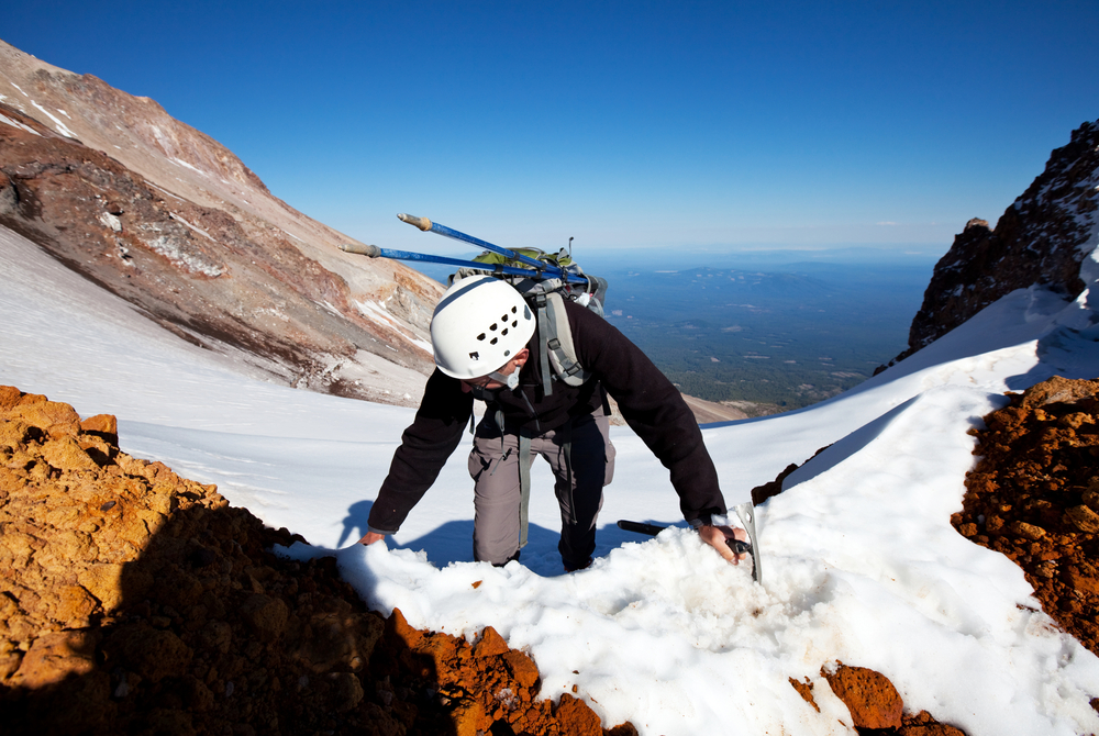
Mount Shasta stands as a solitary volcanic sentinel at 14,179 feet, the second-highest peak in the Cascades and one of the most majestic mountains in the American West. The Avalanche Gulch route is the most popular non-technical path to the summit, but make no mistake: this is a serious mountaineering endeavor requiring crampons, an ice axe, and the knowledge to use them.
The route ascends from Bunny Flat at 6,950 feet through alpine meadows to the Sierra Club’s historic Horse Camp cabin, then continues up snowfields to Lake Helen at 10,443 feet, where most climbers camp before a pre-dawn summit push. The final stretch up the Red Banks, a band of volcanic rock, leads to Misery Hill and then the summit, where climbers are rewarded with views stretching from the Oregon Cascades to the Sierra Nevada. Rockfall, altitude sickness, and rapidly changing weather are serious hazards. Guided trips are available and recommended for first-time summit climbers.
26. Bonus: John Muir Trail (Thru-Hike)
The John Muir Trail is widely considered one of the greatest long-distance hiking trails in the world. Stretching 211 miles from Happy Isles in Yosemite Valley to the summit of Mount Whitney, the highest peak in the contiguous United States, the JMT traverses the heart of the Sierra Nevada through some of the most spectacular mountain scenery on Earth. The trail crosses six mountain passes above 11,000 feet, including the 13,180-foot Forester Pass, the highest point on the Pacific Crest Trail.
Along the way, hikers pass through pristine alpine meadows, beside crystal-clear lakes, through ancient forests, and beneath towering granite peaks. The trail shares roughly 160 miles with the Pacific Crest Trail, which was made famous by Cheryl Strayed’s memoir Wild. Completing the JMT requires significant physical conditioning, careful resupply planning (there are no towns along the route), and a bear canister for food storage.
Permits are distributed through a competitive lottery, and most thru-hikers complete the trail in two to three weeks. For many, it is a once-in-a-lifetime experience that redefines their relationship with the natural world.
Essential Gear & Preparation Tips
Regardless of which trail you choose, certain fundamentals apply to every California hike. Hydration is critical, as the state’s Mediterranean climate means dry conditions for much of the year. Carry at least one liter of water per two miles of hiking, more in exposed desert terrain. Sun protection including a hat, sunglasses, and SPF 30+ sunscreen is essential on most trails, as shade can be scarce even in the mountains. Wear broken-in hiking boots with ankle support for anything beyond paved paths, and always bring layers, as California’s microclimates mean temperatures can swing 30 degrees between a shady canyon floor and an exposed ridgeline.
California wildfire season typically runs from late spring through fall, and trail closures can occur with little notice. Check the CAL FIRE and individual park websites for current fire conditions before every trip. Many popular trailheads now require advance parking reservations or day-use permits, so planning ahead is more important than ever. Download offline maps (AllTrails, Gaia GPS, or CalTopo are excellent options) and carry a physical map and compass as a backup. Cell service is nonexistent in most wilderness areas.
Finally, practice Leave No Trace principles on every outing. Pack out all trash, stay on designated trails, yield to uphill hikers, keep noise to a minimum, and store food properly in bear country. California’s trails are a shared treasure, and their preservation depends on every hiker doing their part.
Disclaimer: Trail conditions, permit requirements, and fees are subject to change. Always verify current information with the relevant land management agency before planning your trip. This article is intended for informational purposes and does not constitute professional outdoor recreation advice. Hike at your own risk.